Most weather maps bury what matters under menus and ads. WindTrac is one clean, animated map you can read at a glance — wind, waves, and rain from the world's best models, no setup, no account. It also draws official weather warnings and live hurricane tracks straight on the map, and it is the only one that downloads a full region for use with no signal. Powerful forecasts, refreshingly simple.
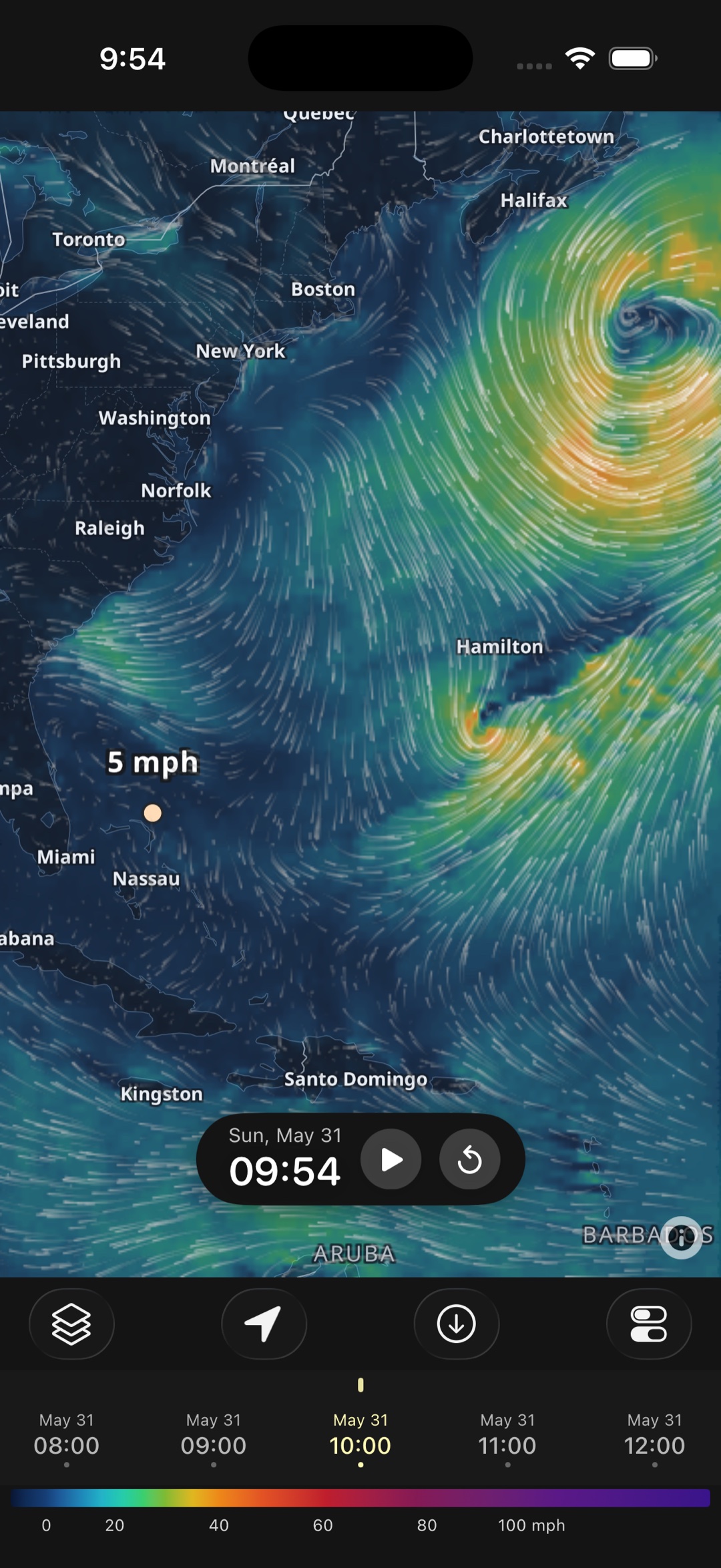
Wind, gusts, waves, wave period, precipitation, cloud and temperature — rendered as flowing streamlines and smooth colour heatmaps. Switch layers instantly and read the conditions anywhere.
Tens of thousands of particles flow along the wind field, with speed shown in colour — a living picture of where the air is moving. Read it at the surface or climb through the 950, 900, 850, 800, 700, 500 and 250 hPa levels.
Peak gust rather than sustained wind — the number that decides whether a sail, a wing or a small boat is manageable, and the one averages hide.
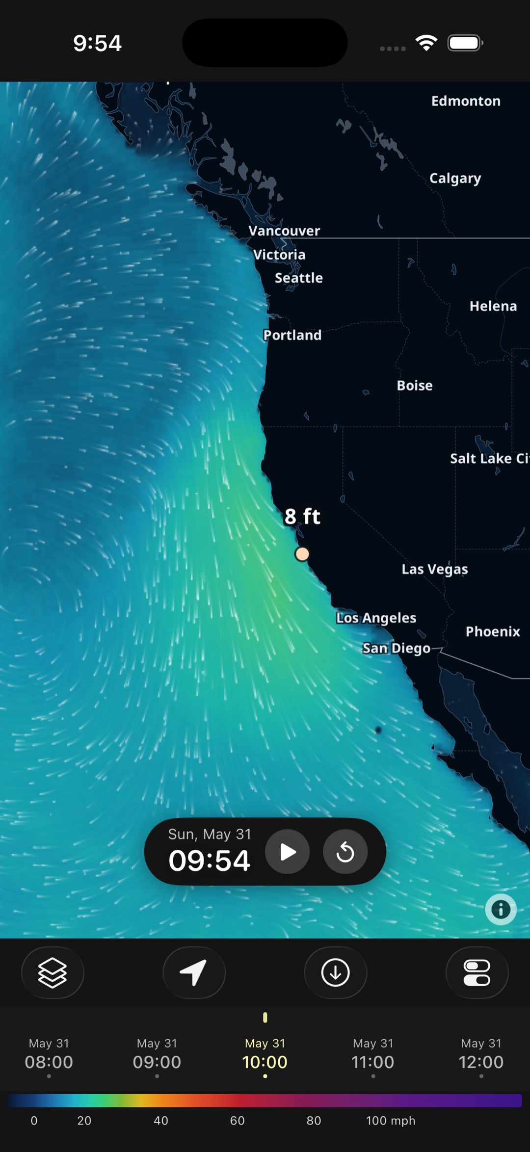
Significant wave height as a smooth heatmap, plus wave direction — so you can see swell building and where it's headed. Switch to peak period to tell a long, clean groundswell from short, steep windchop.
Rain and snow intensity painted across the map, frame by frame, so you can watch systems track in and clear out.
Low cloud — the layer that actually decides whether you get sun, a grey afternoon, or a usable window for photography and flying.
Air temperature at 2 m in °C or °F, so you know what to wear as well as what the wind is doing.
WindTrac turns raw forecast grids into something you can actually see — animated, interactive, and precise down to the point you tap.
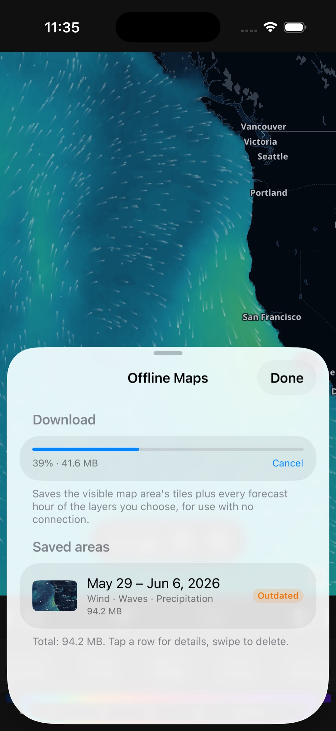
WindTrac's standout feature: with WindTrac Pro, download a region and its full forecast — wind, waves, and the basemap — for use with no connection at all. The animation, layers, and timeline keep working offshore, in the backcountry, or anywhere coverage drops. Pro also extends forecasts beyond 72 hours; the free tier always covers the next three days.
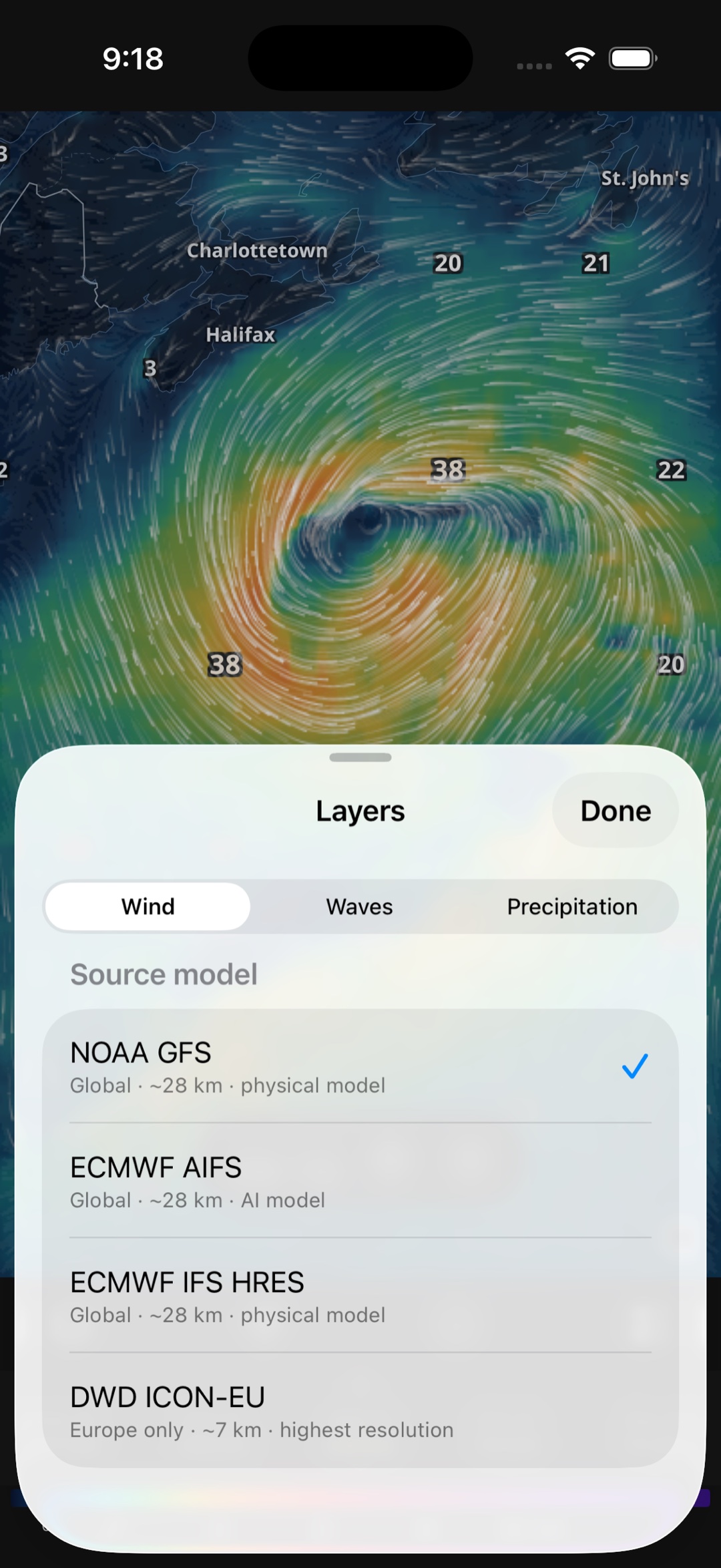
Compare global and regional models without leaving the map. Run NOAA GFS worldwide, switch to DWD ICON-EU for high-resolution Europe, try ECMWF's AIFS AI model or IFS HRES, and overlay GFS-Wave or ECMWF wave models. The model is selectable per layer, so wind and waves can come from different sources at the same time.
Tap anywhere to read the exact wind speed or wave height at that point, with labels at notable extrema. Save the spots you watch and jump straight back to them, snap to your current location, and show times in your device's zone, the viewed location's zone, or UTC.
Forecast models tell you what the atmosphere is doing. Storm Watch tells you what your national weather service has actually decided to warn about — drawn on the same map, free for everyone.
Live alerts from the US National Weather Service and Environment Canada, drawn where they actually apply — the real warning polygon for a tornado or severe thunderstorm, and the county or marine zone for everything else. Tap any alert to read the full official text, including the instructions the forecaster wrote. Choose which categories you want: severe thunderstorms, tornadoes, floods, wildfire, marine, winter, heat, and more.
Active tropical cyclones from the NOAA National Hurricane Center: the forecast cone, the track, and the 34-knot wind field — the tropical-storm-force threshold that decides whether anyone goes on the water. Because the wind field carries its own valid time, scrubbing the timeline walks it along the track, so you can see when damaging wind is forecast to reach a specific place. Areas being watched for development appear before anything is named.
Observed tornado, wind and hail reports collated by the NOAA Storm Prediction Center, plotted where they were reported with the measured gust or hail size. Useful for reading how a system behaved rather than only how it was forecast to.
WindTrac doesn't guess. Every layer is rendered from public forecast data published by national and international weather agencies — choose the model that fits your region and your question.
The U.S. Global Forecast System — worldwide coverage for wind and precipitation, updated through the day. WindTrac's default global model.
Global · Wind · PrecipGermany's national weather service runs ICON-EU at high resolution over Europe — sharper detail where the terrain and coastlines demand it.
Europe · High-resECMWF's machine-learning forecast model — a fast, data-driven take on the global atmosphere you can compare against the physics-based runs.
Global · AI modelECMWF's flagship high-resolution global model, widely regarded as one of the most accurate medium-range forecasts in the world.
Global · High-resNOAA's global wave model — significant wave height and direction, rendered as a smooth heatmap you can play through hour by hour.
Global · WavesECMWF's global wave model as an alternate wave source — switch between wave models the same way you switch atmospheric ones.
Global · WavesThe full interactive map — every layer and every model, with forecasts up to 72 hours — is free, with no account. WindTrac Pro adds offline maps and longer-range forecasts.
No account needed.
Each plan starts with a 7-day free trial. Auto-renews; cancel anytime in your Apple ID or Google Play settings.
Subscriptions are sold as auto-renewing subscriptions through the Apple App Store (iOS) and Google Play (Android). The free trial converts to a paid subscription unless cancelled at least 24 hours before it ends. Manage or cancel anytime in your Apple ID or Google Play account settings. The paywall is powered by Superwall.
From public forecast grids to a live map, in three steps.
Launch the app — no account, no setup. The wind comes to life immediately, anywhere on the globe.
Switch between wind, gusts, waves, wave period, precipitation, cloud and temperature, and choose the model per layer — NOAA GFS, DWD ICON-EU, or ECMWF.
Scrub or auto-play the timeline, tap to read exact values, and save the spots you care about. Go Pro for offline and longer range.
Yes, and they are free. WindTrac draws live watches, warnings and advisories from the US National Weather Service and Environment Canada directly on the map — the true warning polygon for storm-based products like tornado and severe thunderstorm warnings, and the county or marine zone for the rest. Tap an alert to read the full official text and instructions. You can switch individual categories on or off under Storm Watch in Settings.
Yes. WindTrac shows active tropical cyclones from the NOAA National Hurricane Center, including the forecast cone, the forecast track, and the 34-knot (tropical-storm-force) wind field. The wind field is tied to the timeline, so scrubbing forward moves it along the track and shows when damaging wind is forecast to arrive. Areas being watched for development are shown before a storm is named. Coverage is the Atlantic, eastern Pacific and central Pacific basins, which is what the National Hurricane Center issues.
No. WindTrac is an independent app built by Rivolu LLC. It displays public data published by NOAA, the US National Weather Service, the National Hurricane Center, Environment Canada, ECMWF and DWD, but it is not affiliated with, endorsed by, or approved by any of them. Always follow official warning sources; WindTrac is not a substitute for them.
WindTrac is an animated, interactive forecast map for wind, waves, and weather. It shows flowing wind particle streamlines across the globe, plus wave and precipitation layers as smooth color heatmaps. You can scrub a timeline through the forecast, tap anywhere to read exact values, and switch between several forecast models. It is a native app for iOS and Android, and works fully offline once you download a region (Pro).
Yes. The full interactive map, every layer, every forecast model, timeline playback, tap-to-read values, and saved locations are free — with no account. Free forecasts cover the next 72 hours. WindTrac Pro unlocks offline maps and forecasts beyond 72 hours.
WindTrac is built on public forecast data: NOAA GFS (global), DWD ICON-EU (high-resolution Europe), ECMWF AIFS (an AI model) and ECMWF IFS HRES, plus GFS-Wave and ECMWF wave models. You can switch the model independently for each layer, so wind and waves can come from different sources at once.
WindTrac Pro unlocks offline maps — download a region and its forecast for use with no connection — and extended forecasts beyond 72 hours. Pro is available as a monthly or yearly subscription, each with a 7-day free trial.
Subscriptions are auto-renewing and sold through the Apple App Store on iOS and Google Play on Android. On iOS, manage or cancel in your Apple ID settings (Settings → your name → Subscriptions); on Android, in Google Play → Payments & subscriptions → Subscriptions. The 7-day free trial converts to a paid subscription unless you cancel at least 24 hours before it ends.
With WindTrac Pro you can download a region and forecast for offline use — handy offshore or anywhere coverage is unreliable. The free tier needs a connection to fetch forecast and basemap data.
No. WindTrac uses your device location only to center the map on your current location and to determine the viewed location's time zone, which is reverse-geocoded on your device. Your location is not sent to or stored on WindTrac servers. See our Privacy Policy for details.
WindTrac is the best simple, ad-free alternative to Windy: the essentials you can read at a glance — wind, gusts, waves, wave period, rain, cloud and temperature, the same class of forecast models (GFS, ICON-EU, ECMWF AIFS), and full offline downloads — free on iOS and Android, with no account. Windy offers far more layers and parameters; WindTrac trades that breadth for simplicity, no ads, and offline use. See the full WindTrac vs Windy comparison.

Open WindTrac and watch the forecast come to life — animated wind, waves, and weather, free on iOS and Android.